question_answer1)
What
is the Easternmost longitude of India?
question_answer2)
What
is the longitude of the Westernmost point of India?
question_answer3)
Which
Indian states have common frontiers with our neighbouring country Bhutan?
question_answer4)
Name
the countries sharing a land boundary with India.
question_answer5)
If
you go to Silvassa, which union territory will you be in?
question_answer7)
Which
Indian states border three countries?
question_answer8)
Name
the group of islands lying in the Arabian sea.
question_answer10)
What
is unique about the 'Indira Point'?
question_answer12)
Which
union territory of India has the least area?
question_answer13)
Which
state of India has the least area?
question_answer15)
What
is the latitude of the Southernmost point on the Indian main land?
question_answer16)
Which
union territory was converted into a state in 1987?
question_answer19)
The
Tropic of Cancer passes through which states of India?
question_answer22)
In
which year did the Indira Point got submerged under the seawater?
question_answer23)
Name
the imaginary line in India along which time is taken as standard time.
question_answer24)
What
is the length of Indian coastline?
question_answer25)
What
is the East-West extension of India in kilometres?
question_answer26)
What
is the position of India in respect of area in the world?
question_answer27)
Name
the water bodies that separate Sri Lanka from India?
question_answer28)
What
is the length of Indian land boundary?
question_answer31)
They
are Russia, Canada, China, United States of America, Brazil and Australia.
question_answer32)
What
is the North-South extension of India in kilometres ?
question_answer33)
Which
latitudinal line divides India into approximately two equal parts?
question_answer34)
What
is the time difference between 1ST and GMT?
question_answer35)
Why
days and nights are almost of equal duration at Kanyakumari?
question_answer36)
Which
country shares the longest boundary with India?
question_answer37)
Which
Indian state has the longest coast line?
question_answer38)
Just
before independence, how were the Provinces and states in India organised?
question_answer39)
What
is the strategic significance of India's location in Asia?
question_answer42)
Why
82030'E has been selected as the Standard Meridian of
India ?
question_answer48)
Why
is Indian Ocean named after our country? Give three reasons.
question_answer50)
When
was the Suez Canal opened? How it has benefitted India?
question_answer55)
Describe
the location and size of India in three
points each.
question_answer56)
What
is the longitudinal extent of India? What is its implication?
question_answer57)
India
has a long coastline which is advantageous. Explain.
question_answer62)
What
is the total land boundary of India?
question_answer63)
What
is the total length of India's coastline?
question_answer64)
Which
neighbour country lies to the South-East of the Nicobar Islands?
question_answer65)
Which
union territories (or part of them) are found on the West coast of India?
question_answer66)
Find
out the number of union territories along the Western and Eastern coasts.
question_answer67)
Find
out area wise which is the smallest and which is the largest
state.
question_answer68)
Name
the group of island lying in the Arabian sea.
question_answer69)
Name
the countries which are larger than India.
question_answer70)
Which
island group of India lies to its South-East?
question_answer71)
Which
island countries are our Southern - neighbours?
question_answer75)
In which hemisphere India is located?
question_answer76)
What is the latitudinal extent of India?
question_answer77)
What is the longitudinal extent of
India?
question_answer78)
Which tropic divides India into almost two equal
parts?
question_answer79)
Name the two Island groups of India.
question_answer80)
What is total area of Indian landmass?
question_answer81)
Which countries are bigger than India in size?
question_answer83)
Which two seas are located around India?
question_answer84)
What is the time lag between Gujarat and
Arunachal Pradesh?
question_answer85)
What is the standard meridian of India?
question_answer86)
From where does Standard Meridian pass in India?
question_answer87)
Why 82° 30' E has been selected as the Standard
Meridian of India?
question_answer88)
Do you justify Indian Ocean's name after India?
question_answer89)
What is the total length and width of India?
question_answer90)
How had India kept her relationship with the
world in ancient times?
question_answer91)
Which ideas from India could reach the world?
question_answer92)
What commodities were taken from India to
various parts of the world?
question_answer93)
How many states and union territories does India
have?
question_answer94)
Which is the smallest and the largest state of
India areawise?
question_answer95)
Name the states which do not have an international
border or lie on the coast.
question_answer96)
Name the states of India, sharing border with
Pakistan.
question_answer97)
Which states of India share border with China?
question_answer98)
Name the states sharing border with Myanmar.
question_answer99)
Which states of India share border with
Bangladesh?
question_answer100)
Which countries share their border with India?
question_answer101)
Which two Island countries are India's
neighbours?
question_answer102)
Which water bodies separates Sri Lanka from
India?
question_answer103)
Name the Eastern coastal states of India.
question_answer104)
Name the Western coastal states from South to
North?
question_answer107)
Name the states through which the Tropic of
Cancer passes.
question_answer108)
Name the place situated on three seas of India.
question_answer109)
Name the union territories of India.
question_answer111)
Why is 82° 30' E selected as the Standard
Meridian of India?
question_answer112)
Name the countries which are larger than India.
question_answer113)
What is the significance of India's central
location?
question_answer115)
What do you know about the size of India?
question_answer117)
What are India's unique locational features?
question_answer118)
What is the location of India in the world?
question_answer120)
How has India developed relationships with the
world through the land route?
question_answer127)
Why 82°30' E has been as the standard meridian
of India?
question_answer129)
What is the significance of India's central location?


You need to login to perform this action.
You will be redirected in
3 sec


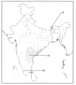
 (a)
Two features are shown on the political outline map of India. Identify these
features and write their names on the lines marked on the map.
(i) This is the smallest state in area
(ii) This state borders both Bangladesh and Myanmar
(b) On the map, locate and label the following with
appropriate symbols.
1 This state is the most sparsely populated state in India
2 This is the largest state in area
(a)
Two features are shown on the political outline map of India. Identify these
features and write their names on the lines marked on the map.
(i) This is the smallest state in area
(ii) This state borders both Bangladesh and Myanmar
(b) On the map, locate and label the following with
appropriate symbols.
1 This state is the most sparsely populated state in India
2 This is the largest state in area

 (i) The island groups of India lying in the Arabian sea
and the Bay of Bengal.
(ii) The countries constituting the Indian subcontinent.
(iii) The states through which the Tropic of Cancer passes.
(iv) The Northernmost latitude in degrees.
(v) The Southernmost latitude of the Indian main land in
degrees.
(vi) The Eastern and the Westernmost longitude in degrees.
(viii) The place situated on the three seas.
(viii) The strait separating Sri Lanka from India.
(ix) The Union Territories of India.
(i) The island groups of India lying in the Arabian sea
and the Bay of Bengal.
(ii) The countries constituting the Indian subcontinent.
(iii) The states through which the Tropic of Cancer passes.
(iv) The Northernmost latitude in degrees.
(v) The Southernmost latitude of the Indian main land in
degrees.
(vi) The Eastern and the Westernmost longitude in degrees.
(viii) The place situated on the three seas.
(viii) The strait separating Sri Lanka from India.
(ix) The Union Territories of India.