Current Affairs UPSC

  Atmospheric pressure  
  • Air expands when heated and gets compressed when cooled.
  • This results in variations in the atmospheric pressure.
  • The result is that it causes the movement of air from high pressure to low pressure, setting the air in motion.
  • The wind redistributes the heat and moisture across the planet, thereby, maintaining a constant temperature for the planet as a whole.
  • The vertical rising of moist air cools it down to form the clouds and bring precipitation.
  • Do you realise that our body is subjected to a lot of air pressure.
  • As one moves up the air gets varified and one feels breathless.
  • The weight of a column of air contained in a unit area from the mean sea level to the top of the atmosphere is called the atmospheric pressure.
  • The atmospheric pressure is expressed in units of milibar.
  • At sea level the average atmospheric pressure is 1,013.2 milibar.
  • Due to gravity the air at the surface is denser and hence has higher pressure.
  • Air pressure is measured with the help of a mercury barometer or the aneroid barometer.
  • The pressure decreases with height.
  • At any elevation it varies from place to place and its variation is the primary cause of air motion, i.e. wind which moves from high pressure areas to low pressure areas.
  • The vertical pressure gradient force is much larger than that of the horizontal pressure gradient.
  • But, it is generally balanced by a nearly equal but opposite gravitational force. Hence, we do not experience strong upward winds.
  Horizontal Distribution of Pressure
  • Horizontal distribution of pressure is studied by drawing isobars at constant levels.
  • Isobars are lines connecting places having equal pressure.
  • In order to eliminate the effect of altitude on pressure, it is measured at any station after being reduced to sea level for purposes of comparison.
  World Distribution of Sea Level Pressure
  • Near the equator the sea level pressure is low and the area is known as equatorial low.
  • Along 30°N and 30°S are found the high-pressure areas known as the subtropical highs.
  • Further pole wards along 60°N and 60°S, the low-pressure belts are termed as the sub polar lows. Near the poles the pressure is high and it is known as the polar high.
  • These pressure belts are not permanent in nature. They oscillate with the apparent movement of the sun.
  • In the northern hemisphere in winter they move southwards and in the summer northwards.
  Forces Affecting the Velocity and Direction of Wind  

  Group A: Tropical Humid Climates  
  • Tropical humid climates exist between Tropic of Cancer and Tropic of Capricorn.
  • The sun being overhead throughout the year and the presence of Inter Tropical Convergence Zone (TTCZ) make the climate hot and humid.
  • Annual range of temperature is very low and annual rainfall is high.
  • The tropical group is divided into three types, namely:
  • Af - Tropical wet climate;
  • Am - Tropical monsoon climate;
  • Aw - Tropical wet and dry climate.
  • Tropical Wet Climate (Af)
  • Tropical wet climate is round near the equator the major areas are the Amazon Basin in South America, western equatorial Africa and the islands of East Indies.
  • Significant amount of rainfall occurs in every month of the year as thunder showers in the afternoon.
  • The temperature is uniformly high and the annual range of temperature is negligible.
  • The maximum temperature on any day is around 30°C while the minimum temperature is around 20°C.
  • Tropical evergreen forests with dense canopy cover and large biodiversity are found in mis climate.
  Tropical Monsoon Climate (Am)
  • Tropical monsoon climate (Am) is found over me Indian sub-continent. North Eastern part of South America and Northern Australia. Heavy rainfall occurs mostly in summer. Winter is dry.                                
  Tropical Wet and Dry Climate (Aw)
  • Tropical wet and dry climate occurs north and south of Af type climate regions.
  • It borders with dry climate on me western part of me continent and Cf or Cw on me eastern part.                                
  • Extensive Aw climate is found to the north and soum of the Amazon forest in Brazil and adjoining parts of Bolivia and Paraguay in South America, Sudan and south of Central Africa.                                
  • The annual rainfall in this climate is corisiderably less than that in Af and Am climate types and is variable also.                               
  • The wet season is shorter and me dry season is longer with me drought being more severe.                  
  • Temperature is high throughout the year and diurnal ranges of temperature are the greatest in the dry season.
  • Deciduous forest and tree-shredded grasslands occur in this climate.
    Dry Climates : (B)  
  • Dry climates are characterised by very low rainfall that is not adequate for the growth of plants.
  • These climates cover a very large area of the planet extending over large latitudes from 15°-60° north and south of the equator.
  • At low latitudes, from 15°-30°, they occur in the area of subtropical high where subsidence and more...

  Water Vapour  
  • Air contains water vapour. It varies from zero to four per cent by volume of the atmosphere and plays an important role in the weather phenomena.
  • Water is present in the atmosphere in three forms namely - gaseous, liquid and solid.
  • The moisture in the atmosphere is derived from water bodies through evaporation and from plants through transpiration.
  • Thus, there is a continuous exchange of water between the atmosphere, the oceans and the continents through the processes of evaporation, transpiration, condensation and precipitation.
  • Water vapour present in the air is known as humidity. It is expressed quantitatively in different ways.
  • The actual amount of the water vapour present in the atmosphere is known as the absolute humidity. It is the weight of water vapour per unit volume of air and is expressed in terms of grams per cubic metre.
  • The ability of the air to hold water vapour depends entirely on its temperature.
  • The absolute humidity differs from place to place on the surface of the earth.
  • The percentage of moisture present in the atmosphere as compared to its full capacity at a given temperature is known as the relative humidity.
  • With the change of air temperature, the capacity to retain moisture increases or decreases and the relative humidity is also affected. It is greater over the oceans and least over the continents.
  • The air containing moisture to its full capacity at a given temperature is said to be saturated.
  • It means that the air at the given temperature is incapable of holding any additional amount of moisture at that stage.
  • The temperature at which saturation occurs in a given sample of air is known as dew ‘point.
   Evaporation and Condensation  
  • The amount of water vapour in the atmosphere is added or withdrawn due to evaporation and condensation respectively.
  • Evaporation is a process by which water is transformed from liquid to gaseous state.
  • Heat is the main cause for evaporation.
  • The temperature at which the water starts evaporating is referred to as the latent heat of vapourisation.
  • Increase in temperature increases water absorption and retention capacity of the given parcel of air.
  • Similarly, if the moisture content is low, air has a potentiality of absorbing and retaining moisture.
  • Movement of air replaces the saturated layer with the unsaturated layer.
  • Hence, the greater the movement of air, the greater is the evaporation.
  • The transformation of water vapour into water is called condensation.
  • Condensation is caused by the loss of heat
  • When moist air is more...

  Weather  
  • Weather is the momentary state of the atmosphere while climate refers to the average of the weather conditions over a longer period of time.
  • Weather changes quickly, may be within a day or week but climate changes imperceptively and may be noted after 50 years or even more.
  Factors Determining the Climate of India   Latitude
  • The Tropic of Cancer passes through me central part of India in east-west direction.
  • Thus, northern part of the India lies in sub-tropical and temperate zone and the part lying south of me Tropic of Cancer falls in me tropical zone.
  • The tropical zone being nearer to me equator, experiences high temperatures throughout me year with small daily and annual range.
  • Area north of me Tropic of Cancer being away from the equator, experiences extreme climate with high daily and annual range of temperature.
  The Himalayan Mountains
  • The lofty Himalayas in the north along with its extensions act as an effective climatic divide.
  • The towering mountain chain provides an invincible shield to protect the subcontinent from the cold northern winds.
  • These cold and chilly winds originate near the Arctic circle and blow across central and eastern Asia.
  • The Himalayas also trap me monsoon winds, forcing them to shed their moisture within me subcontinent
  Distribution of Land and Water
  • India is flanked by me Indian Ocean on three sides m me south and girdled by a high and continuous mountain-wall in me norm.
  • As compared to me landmass, water heats up or cools down slowly.
  • This differential heating of land and sea creates different air pressure zones in different seasons in and around me Indian subcontinent
  • Difference in air pressure causes reversal in me direction of monsoon winds.
  Distance from the Sea
  • With a long coastline, large coastal areas have an equable climate. Areas in the interior of India areas have extremes of climate
  • That is why, the people of Mumbai and the Konkan coast have hardly any idea of extremes of temperature and the seasonal rhythm of weather.
  • On the other hand, the seasonal contrasts in weather at places in the interior of the country such as Delhi, Kanpur and Amritsar affect me entire sphere of life.
  Altitude
  • Temperature decreases with height Due to thin air, places in the mountains are cooler than places on the plains.
  • For example, Agra and Darling are located on the same latitude, but temperature of January in Agra is 16°C whereas it is only 4°C in Darling
  Relief
  • The physiography or relief of India also affects the temperature, more...

  Tsunami  
  • Earthquakes and volcanic eruptions that cause the sea-floor to move abruptly resulting in sudden displacement of ocean water in the form of high vertical waves are called tsunamis (harbour waves) or seismic sea waves.
  • Normally, the seismic waves cause only one instantaneous vertical wave; but, after the initial disturbance, a series of after waves are created in the water that oscillate between high crest and low trough in order to restore the water level.
  • The speed of wave in the ocean depends upon the depth of water. It is more in the shallow water than in the ocean deep.
  • As a result of this, the impact of tsunami is less over the ocean and more near the coast where they cause large-scale devastations.
  • Therefore, a ship at sea is not much affected by tsunami and it is difficult to detect a tsunami in the deeper parts of sea.
  • It is so because over deep water the tsunami has very long wave-length and limited wave-height.
  • Thus, a tsunami wave raises the ship only a metre or two and each rise and fall takes several minutes.
  • As opposed to this, when a tsunami enters shallow water, its wave-length gets reduced and the period remains unchanged, which increases the wave height.
  • Sometimes, this height can be up to 15 m or more, which causes large-scale destructions along the shores.
  • Thus, these are also called Shallow Water Waves. Tsunamis are frequently observed along the Pacific ring of fire, particularly along the coast of Alaska, Japan, Philippines, and other islands of Southeast Asia, Indonesia, Malaysia, Myanmar, Sri Lanka, and India etc.
  Tropical Cyclone  
  • Tropical cyclones are intense low-pressure areas confined to the area lying between 30°N and 30°S latitudes, in the atmosphere around which high velocity winds blow.
  • Horizontally, it extends up to 500-1,000 km and vertically from surface to 12-14 km.
  • A tropical cyclone or hurricane is like a heat engine that is energised by the release of latent heat on account of the condensation of moisture that the wind gathers after moving over the oceans and seas.
  • There are differences of opinion among scientists about the exact mechanism of a tropical cyclone. However, some initial conditions for the emergence of a tropical cyclone are:                                                                              
  • Large and continuous supply of warm and moist air that can release enormous latent heat.
  • Strong Coriolis force that can prevent filling of low pressure at the centre (absencence of Coriolis force near the equator prohibits the formation of tropical cyclone between 0°-5° latitude).           
  • Unstable condition through the troposphere more...

  Drainage System  
  • An area drained by a river and its tributaries is called a drainage basin. The boundary line separating one drainage basin from the other is known as the watershed.
  • The catchments of large rivers are called river basins while those of small rivulets and rills are often referred to as watersheds.
  • On the basis of the mode of origin, nature and characteristics, the Indian drainage may also be classified into the Himalayan drainage and the Peninsular drainage.
  • Although it has the problem of including the Chambal, the Betwa, the Son, etc. which are much older in age and origin than other rivers that have their origin in the Himalayas, it is the most accepted basis of classification.
   Important Drainage Patterns  
  • The drainage pattern resembling the branches of a tree is known as "dendritic" the examples: of which are the rivers of northern plain.
  • When the rivers originate from a hill and flow in all directions, the drainage pattern is known as 'radial'. The rivers originating from the Amarkantak range present a good example of it.
  • When the primary tributaries of rivers flow parallel to each other and secondary tributaries join them at right angles, the pattern is known as 'trellis'.
  • When the rivers discharge their waters from all directions in a lake or depression, the pattern is know as 'centripetal'.
  The Himalayan Drainage     
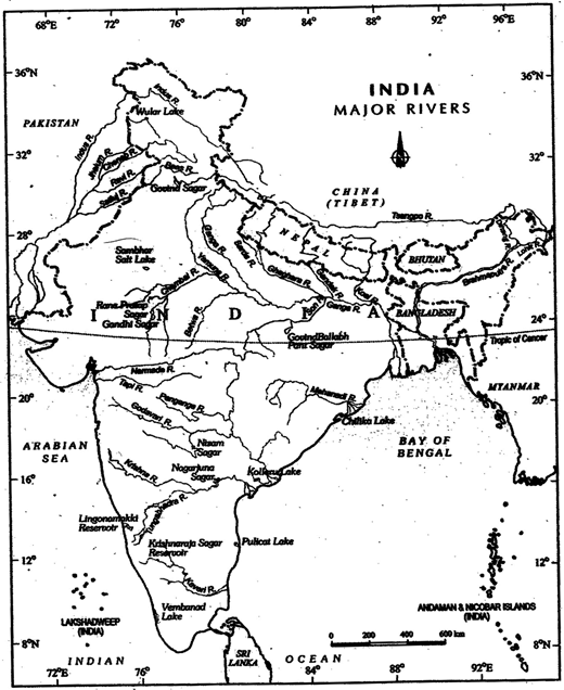
Major Rivers and Lakes  
  • The Himalayan drainage system has evolved through a long geological history. It mainly includes the Ganga, the Indus and the Brahmaputra river basins.
  • Since these are fed both by melting of snow and precipitation, rivers of this system are perennial.
  • These rivers pass through the giant gorges carved out by the erosional activity carried on simultaneously with the uplift of the Himalayas.
  • Besides deep gorges, these rivers also form V-shaped valleys, rapids and waterfalls in their mountainous course.
  • While entering the plains, they form depositional features like flat valleys, ox-bow lakes, flood plains, braided channels, and deltas near the river mouth.
  • In the Himalayan reaches, the course of these rivers is highly tortous, but over the plains they display a strong meandering tendency and shift their courses frequently.
  • River Kosi, also know as the 'sorrow of Bihar', has been notorious for frequently changing its course. The Kosi brings huge quantity of sediments from its more...

  Forests   Tropical Evergreen Forests
  • These forests are also called tropical rainforests. These thick forests occur in the regions near the equator and close to the tropics. These regions are hot and receive heavy rainfall throughout the year.
  • As there is no particular dry season, the trees do not shed their leaves altogether. This is the reason they are called evergreen.
  • The thick canopies of the closely spaced trees do not allow the sunlight to penetrate inside the forest even in the day time. Hardwood trees like rosewood, ebony, mahogany are common here.
  Tropical Deciduous Forests
  • Tropical deciduous are the monsoon forests found in the large part of India, northern Australia and in central America.
  • These regions experience seasonal changes. Trees shed their leaves in the dry season to conserve water. The hardwood trees found in these forests are sal, teak, neem and shisham.
  • Hardwood trees are extremely useful for making furniture, transport and constructional materials.
  • Tigers, lions, elephants, langoors and monkeys are the common animals of these regions.
  Temperate Evergreen Forests
  • The temperate evergreen forests are located in the mid-latitudinal coastal region.
  • They are commonly found along the eastern margin of the continents, e.g., In south east USA, South China and in South East Brazil. They comprise both hard and soft wood trees like oak, pine, eucalyptus, etc.
  Temperate Deciduous Forests
  • As we go towards higher latitudes, there are more temperate deciduous forests. These are found in the north eastern part of USA, China, New Zealand, Chile and also found in the coastal regions of Western Europe.
  • They shed their leaves in the dry season. The common trees are oak, ash, beech, etc. Deer, foxes, wolves are the animals commonly found. Birds like pheasants, monals are also found here.
  Mediterranean Vegetation
  • Most of the east and north east margins of the continents are covered by temperate evergreen and deciduous trees. The west and south west margins of the continent are different.                                
  • They have Mediterranean vegetation. It is mostly found in the areas around the Mediterranean sea in Europe, Africa and Asia, hence the name.
  • This kind of vegetation is also found outside the actual Mediterranean region in California in the USA, south west Africa, south western South America and South west Australia.
  • These regions are marked for hot dry summers and mild rainy winters.
  • Citrus fruits such as oranges, figs, olives and grapes are commonly cultivated here because people have removed the natural vegetation in order to cultivate what they want to. There isn't much wildlife here.
  • Mediterranean trees adapt themselves to dry summers with the help of their thick barks and wax coated leaves which help them reduce transpiration.
  • more...

  Types of Forests   Tropical Evergreen and Semi Evergreen Forests
  • These forests are found in the western slope of the Western Ghats, hills of the northeastern region and the Andaman and Nicobar Islands.
  • They are found in warm and humid areas with an annual precipitation of over 200 cm and mean annual temperature above 22°C.
  • Tropical evergreen forests are well stratified, with layers closer to the ground and are covered with shrubs and creepers, with short structured trees followed by tall variety of trees.
  • In these forests, trees reach great heights up to 60 m or above.
  • There is no definite time for trees to shed their leaves, flowering and fruition.
  • As such these forests appear green all the year round. Species found in these forests include rosewood, mahogony, aini, ebony, etc.
  • The send evergreen forests are found in the less rainy parts of these regions.
  • Such forests have a mixture of evergreen and moist deciduous trees.
  • The under growing climbers provide an evergreen character to these forests. Main species are white cedar, bollock and kail.
  Tropical Deciduous Forests
  • These are the most widespread forests in India. They are also called the monsoon forests.
  • They spread over regions which receive rainfall between 70-200 cm. On the basis of the availability of water, these forests are further divided into moist and dry deciduous.
  • The Moist deciduous forests are more pronounced in the regions which record rainfall between 100-200 cm.
  • These forests are found in the northeastern states along the foothills of Himalayas, eastern slopes of the Western Ghats and Odisha. Teak, sal, shisham, hurra, mahua, amia, semul, kusum, and sandalwood etc. are the main species of these forests.
  • Dry deciduous forest covers vast areas of the country, where rainfall ranges between 70-100 cm.
  • On the wetter margins, it has a transition to the moist deciduous, while on the drier margins to thorn forests.
  • These forests are found in rainier areas of the Peninsula and the plains of Uttar Pradesh and Bihar.
  • In the higher rainfall regions of the Peninsular plateau and the northern Indian plain, these forests have a parkland landscape with open stretches in which teak and other trees interspersed with patches of grass are common.
  • As the dry season begins, the trees shed their leaves completely and the forest appears like a vast grassland with naked trees all around.
  • Tendu, palas, amaltas, bel, khair, axlewood, etc. are the common trees of these forests.
  • In the western and southern part of Rajasthan, vegetation cover is very scanty due to low rainfall and overgrazing.
  • Teak is the most dominant species of this forest. Bamboos, sal, shisham, sandalwood, khair, kusum, arjun, mulberry are other commercially important species.
  Tropical Thorn Forests

  Soils  
  • The soil on which we depend so much for our day-to-day needs has evolved over thousands of years.
  • The various agents of weathering and gradation have acted upon the parent rock material to produce a thin layer of soil.
  • Soil is the mixture of rock debris and organic materials which develop on the earth's surface.
  • The major factors affecting the formation of soil are relief, parent material, climate, vegetation and other life-forms and time.
  • Besides these, human activities also influence it to a large extent.
  • Components of the soil are mineral particles, humus, wafer and air. The actual amount of each of these depend upon the type of soil.
  Classification of Soils  
  • The National Bureau of Soil Survey and the Land Use Planning an Institute under the control of the Indian Council of Agricultural Research (ICAR) did a lot of studies on Indian soils.
  • In their effort to study soil and to make it comparable at the international level, the ICAR has classified the Indian soils on the basis of their nature and character as per the United States Department of Agriculture (USDA) Soil Taxonomy.
  • On the basis of genesis, colour, composition and location, the soils of India have been classified into : Alluvial soils. Black soils. Red and Yellow soils, Laterite soils. Arid soils, Saline soils. Peaty soils, Forest soils.
  Alluvial Soils
  • Alluvial soils are widespread in the northern plains and the river valleys.
  • These soils cover about 40 per cent of the total area of the country.
  • They are depositional soils, transported and deposited by rivers and streams.
  • Through a narrow corridor in Rajasthan, they extend into the plains of Gujarat.
  • In the Peninsular region, they are found in deltas of the east coast and in the river valleys. The alluvial soils vary in nature from sandy loam to clay.
  • They are generally rich in potash but poor in phosphorous.
  • In the Upper and Middle Ganga plain, two different types of alluvial soils have developed, viz. Khadar and Bhangar.
  • Khadar is the new alluvium and is deposited by floods annually, which enriches the soil by depositing fine silts.
  • Bhangar represents a system of older alluvium, deposited away from the flood plains.
  • Both the Khadar and Bhangar soils contain calcareous concretions (Kankars).
  • These soils are more loamy and clayey in the lower and middle Ganga plain and the Brahamaputra valley.
  • The sand content decreases from the west to east.
  • The colour of the alluvial soils varies from the light grey to ash grey.
  • Its shades depend on the depth of the deposition, the texture of the materials, and the time taken for more...

  Water Resources  
  • Water is a cyclic resource with abundant supplies on the globe.
  • Apprpxmiately, 71 percent of the earth's surface is covered with it but fresh water constitutes only about 3 per cent of the total water.
  • In Intact, a very small proportion of fresh water is effectively available for human use.
  • India accounts for about 2.45 per cent of world's surface area, 4 per cent of the world's water resources and about 16 per cent of world's population.       
  • The total water available from precipitation in the country in a year is about 4,000 cubic km.
  • The .availability from surface water and replenishable groundwater is 1,869 cubic km. Out of this only 60 per cent can be put to beneficial uses.
  • Thus, the total utilisable water resource in the country is only 1,122 cubic km.
  • There are four major sources of surface water. These are rivers, lakes, ponds, and tanks.
  • In the country, there are about 10,360 rivers and their tributaries longer than 1.6 km each.
  • The mean annual flow in all the river basins in India is estimated to be 1,869 cubic km.
  • The total replenishable groundwater resources in the country are about 432 cubic km.
  • The Ganga and the Brahamaputra basins, have about 46 per cent of the total replenishable groundwater resources.
  • The level of groundwater utilisation is relatively high in the river basins lying in north- western region and parts of south India.
  • The groundwater utilisation is very high in the states of Punjab, Haryana, Rajasthan, and Tamil Nadu.
  • However, there are States like Chhattisgarh, Odisha, Kerala, etc., which utilise only a small proportion of their groundwater potentials.
  • States like Gujarat, Uttar Pradesh, Bihar, Tripura and Maharashtra are utilising their ground water resources at a moderate rate.
  • India has a vast coastline and the coast is very indented in some states. Due to this, a number of lagoons and lakes have formed.
  • The States like Kerala, Odisha and West Bengal have vast surface water resources in these lagoons and lakes.
  • Although, water is generally brackish in these water-bodies, it is used for fishing and irrigating certain varieties of paddy crops, coconut, etc.
  • In fact, India's water demand at present is dominated by irrigational needs.
  • Agriculture accounts for most of the surface and ground water utilisation, it accounts for 89 per cent of the surface water and 92 per cent of the groundwater utilisation.
  • While the share of industrial sector is limited to 2 per cent of the surface water utilization and 5 per cent of the ground-water, the share of domestic sector is higher (9 per cent) more...


You need to login to perform this action.
You will be redirected in 3 sec spinner