World Population
- The population of the world is unevenly distributed.
- The remark of George B. Cressey about the population of Asia that "Asia has many places where people are few and few place where people are very many" is true about the pattern of population distribution of the world also.
- Broadly, 90 per cent of the world population lives in about 10 per cent of its land area.
Natural Growth of Population
- This is the population increased by difference between births and deaths in a particular region between two points of time.
- Natural Growth = Births - Deaths
- Actual Growth of Population: This is Births - Deaths + In Migration - Out Migration
Positive Growth of Population
- This happens when the birth rate is more than the death rate between two points of time or when people from other countries migrate permanently to a region.
Negative Growth of Population
- If the population decreases between two points of time it is known as negative growth of population.
- It occurs when the birth rate falls below the death rate or people migrate to other countries.
- The crude birth rate (CBR) is expressed as number of live births in a year per thousand of population.
- CDR is expressed in terms of number of deaths in a particular year per thousand of population in a particular region.
Migration
- Apart from birth and death there is another way by which the population size changes.
- When people move from one place to another, the place they move from is called the Place of Origin and the place they move to is called the Place of Destination.
- The place of origin shows a decrease in population while the population increases in the place of destination.
- Migration may be interpreted as a spontaneous effort to achieve a better balance between population and resources. In the first century A.D. it was below 300 million.
- The expanding world trade during the sixteenth and seventeenth century, set the stage for rapid population growth.
- Around 1750, at the dawn of the Industrial Revolution, the world population was 550 million.
- World population exploded in the eighteenth century after the Industrial Revolution.
- Technological advancement achieved so far helped in the reduction of birth rate and provided a stage for accelerated population growth.
- It took more than a million years for the human population to attain the one billion mark. But it took only 12 years for it to rise from 5 billion to 6 billion.
- The ratio between the number of women and men in the population is called the Sex more...
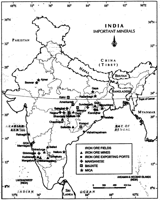 Minerals in India
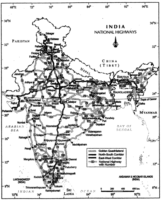 National Highways
State Highways
National Highways
State Highways


